Useful
★ NEW
OSIRIS
Explore public data feeds on an interactive world map, with layers for aviation, satellites, earthquakes, weather, and more. An unusually elaborate way to check what the planet is up to.
VISIT WEBSITE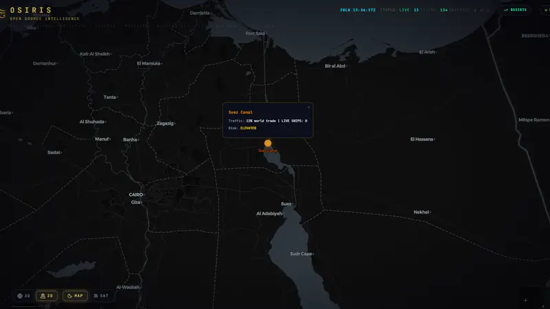
LIVE!
FEATURES
Maps
Open Data
OSINT
Weather
Tracking
QUICK INFO
Category: Useful
Status: Live & Working
Cost: Free to Use
OUR RATING
ABSOLUTELY AMAZING!
WHY WE'RE OBSESSED
It puts otherwise scattered public feeds in one place, so you can explore different kinds of activity without collecting a browser tab for each one.
Switchable layers let you focus on a subject, with natural hazards grouped into earthquakes, active fires, and severe weather.
The API documentation also makes the underlying feeds available for your own projects. Treat the map as a starting point for exploration, not an official emergency alert service.
★ MORE USEFUL WEBSITES